Location
National Land Commission Secretariat
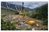
GPS Stations (First Order) Category: Open
The dataset consist of horizontal and vertical coordinates which are very accurate to the cm level in absolute terms. These are used as control coordinates at surveying level control coordinates.

National Land Commission Secretariat
Education Centers - Schools Category: Open
The Education Centers dataset contains comprehensive information about educational institutions, including schools, colleges, and universities. It typically includes data such as institution names, addresses, contact information, number of students, etc.
Keywords: [#school#education#college#student]
National Land Commission Secretariat
Zero Order Stations Category: Restricted
The dataset consist of horizontal and vertical coordinates which are very accurate to the mm level in absolute terms. These are used as control coordinates in geodetic reference frame.
Keywords: [#zero order#station]

Department of Culture and Dzongkha Development
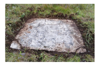
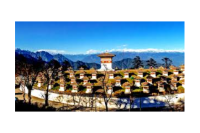
Registered Heritage sites of Bhutan Category: Open
This data contains 198 registered Heritage sites out of 200+ Registered heritage sites.
Keywords: [#member agency#heritage site#cultural preservation#lhakhang]
Department of Energy
Hydropower Components Category: Restricted
This point data provides the location of the existing, under construction and planned hydropower project dams, powerhouse and tail race outlets.
Keywords: [#Hydropower Plant#Dams#Structure#PowerHouse#Tail Race Outlet]

Department of Energy
Power System Master Plan 2040 Category: Restricted
This data provides the location of the 155 planned hydropower projects under Power System Master Plan 2040. It contains the planned dam, reservoir, waterway and powerhouse.
Keywords: [#PSMP 2040#Planned hydropower projects]

National Land Commission Secretariat
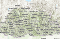
Trek routes Category: Open
The dataset comprises trek routes in Bhutan, surveyed since 2017 using Handheld GPS devices with a 10-meter accuracy. These routes serve tourists, trekkers, hikers, and mountain bikers, facilitating outdoor exploration. The primary objective is to develop guide maps and apps for user convenience. While some routes have undergone feasibility studies, others require further ground validation. the dataset offers a resource for adventure enthusiasts exploring the diverse landscapes of Bhutan.
Keywords: [#trek route#trek name]

National Land Commission Secretariat
Waypoints Category: Open
The waypoints dataset for trek routes in Bhutan offers crucial geographic reference points collected using handheld GPS devices, aiding trekkers in route planning, navigation, and exploration. These waypoints serve to enhance the outdoor experience by coordinates and facilitating the discovery of scenic attractions, cultural sites, and natural landmarks along the trekking routes.
Keywords: [#trek#waypoint#elevation]
National Land Commission Secretariat
Geographic Names Standardized Category: Open
This data contains the standardized village names in Bhutan achieved through a collaborative effort led by the Department of Local Governance and Disaster Management (DLGDM), with participation from key stakeholders including the National Land Commission Secretariat (NLCS), Department of Civil Registration and Census (DCRC), Department of Culture and Dzongkha Development (DoCDD), and the Election Commission of Bhutan (ECB).
Keywords: [#standardized#village#dzongkhag]
National Land Commission Secretariat
Geographic Names Unstandardized Category: Open
This data contains the unstandardized Geographical names in Bhutan which was compiled by the Geoinformatics division with the help of Topographic division of NLCS through collaborations with LGs (Local governments) and local communities.
Keywords: [#unstandardized#dratshang#land mark#village#tsamdro#chiwog#gewog#lhakhang#school#lake#hill#goenpa#farm#town#grazing land#guest house]
Department_of_Geology_and_Mines
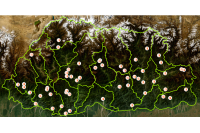
Source Monitoring Station Category: Open
The establishment of the earthquake monitoring station commenced in 2015 and was successfully completed in 2019. Its primary objective is to disseminate crucial earthquake-related information to enhance public awareness and preparedness. Recently, the Department of Geology and Mines (DGM) has been processing waveform data to verify earthquake occurrences. This analysis plays a vital role in generating a seismicity map, which helps identify regions prone to seismic activity. Furthermore, these efforts contribute to delineating possible active faults within the country, strengthening the understanding of Bhutan’s seismic landscape and supporting disaster mitigation strategies.
Keywords: [#Geophysics#Earthquake#station]

National Land Commission Secretariat
Land Use Land Cover 2020 Category: Open
The Land Use Land Cover (LULC) 2020 map of Bhutan highlights major land cover types, with forests dominating at 69% (a slight decrease from 2016). Other significant categories include Snow and Glacier (4.83%), Shrubs (4.11%), and Alpine Scrubs (8.89%, up from 3.39% in 2016). Minor covers include agriculture (2.96%), water bodies (0.61%), and built-up areas (0.25%). The map has an overall accuracy of 87% (kappa 0.853).The Sentinel-2 imagery, acquired from ESA's Copernicus Open Access Hub, underwent several pre-processing steps. The image classification was carried out using random forest technique using the e-cognition software.
Keywords: [#lulc#agriculture#built up#forest#grassland#barren land#glacier#snow#water#landslide#vegetation#meadow]
Department_of_Geology_and_Mines
Dzongkhag Intensity Meter Station Category: Open
To monitor and assess ground shaking intensity at specific sites during an earthquake, intensity meters are installed in every Dzongkhag. These meters detect seismic activity to support post-disaster analysis. Stations are primarily located in populated areas to facilitate effective response and relief measures in regions prone to severe damage.
Keywords: [#Earthquake Station]
Department_of_Geology_and_Mines
Gewog Intensity Meter Station Category: Open
To effectively monitor and assess the intensity of ground shaking during seismic events, intensity meters have been strategically installed across all gewogs, with the exception of four: Soe and Lingzhi in Thimphu Dzongkhag, and Laya and Lunana in Gasa Dzongkhag. These instruments are designed to detect and record seismic activity in real time, providing critical data that supports detailed post-earthquake analysis and damage assessment.The placement of these stations is prioritized in densely populated or high-risk areas to enhance situational awareness during emergencies. By capturing localized intensity measurements, they play a vital role in guiding timely and informed response actions, facilitating the coordination of relief efforts, and strengthening disaster preparedness in regions susceptible to significant seismic impact.
Keywords: [#Geophysics#Earthquake#station#gewog]
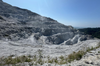
Department_of_Geology_and_Mines
Location of Mines in the Country Category: Open
Bhutan's mining sector primarily extracts industrial minerals like limestone, dolomite, gypsum, marble, ferro-silicon grade quartzite, iron ore, talc, and various construction materials. Due to favorable geological formations and easier market access, the majority of mines and quarries are concentrated in the southern foothills and lower Himalayas, with the central and northern high-altitude regions remaining largely inactive. The predominant extraction method is surface mining. Bhutan's mining policies are uniquely designed to balance economic prosperity with environmental preservation and social equity, aiming to promote in-country value addition and align the sector with the nation's development philosophy.
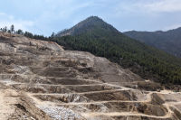
Department_of_Geology_and_Mines
Location of Quarries in the Country Category: Open
Bhutan's mining sector primarily extracts industrial minerals like limestone, dolomite, gypsum, marble, ferro-silicon grade quartzite, iron ore, talc, and various construction materials. Due to favorable geological formations and easier market access, the majority of mines and quarries are concentrated in the southern foothills and lower Himalayas, with the central and northern high-altitude regions remaining largely inactive. The predominant extraction method is surface mining. Bhutan's mining policies are uniquely designed to balance economic prosperity with environmental preservation and social equity, aiming to promote in-country value addition and align the sector with the nation's development philosophy.
Keywords: [#mining#quarry#location]
National Land Commission Secretariat
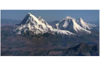
Mountain Passes Category: Open
his dataset contains point features representing mountain passes in Bhutan. Each pass is identified by a unique ID (OBJECTID) and name (passname), with elevation values (height) recorded in meters. The data supports topographic visualization, elevation profiling, and spatial analysis of high-altitude transit routes.
Keywords: []
National Land Commission Secretariat
Mountain Ranges Category: Open
This dataset contains line features representing major mountain ranges across Bhutan. Each range is identified by a unique field ID and range name, with general location coordinates provided for spatial context. The data supports topographic visualization, landscape analysis, and thematic mapping of Bhutan’s physiographic zones.
Keywords: []
National Land Commission Secretariat
Bench Marks Category: Open
The vertical datum heights are carried forward from the mean sea level for determination of heights of earth surface.
Keywords: [#bench mark#station]
National Land Commission Secretariat
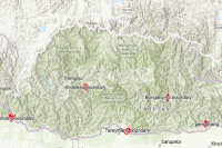
Viewshed Gyalsung Category: Open
This dataset was created to identify and delineate green zone (no-construction) areas surrounding Gyalsung project sites in Bhutan in accordance with official directives to protect peaks, surrounding state land, and visually sensitive areas. Using viewshed analysis based on a Digital Elevation Model (DEM), the data maps areas visible within a 5 km radius from the Gyalsung boundaries and incorporates additional state land near international borders where applicable. The resulting green zone layer serves as a planning and regulatory tool to guide land-use decisions, prevent incompatible development, support environmental conservation, and ensure visual security and landscape protection around the Gyalsung sites.
Keywords: []


Department of Tourism
River Rafting Category: Restricted
An assessment and analysis of the major rivers for raft and kayak tourism, conducted by the Department of Tourism in 2019-2020, with the technical support from Xplore Bhutan. The data is an outcome of the survey. The main purpose of the survey was to run and map rivers to make recommendations for their future use in commercial and recreational running.
Keywords: []

Bhutan Construction & Transport Authority
Bus Terminal Category: Restricted
The data can be used by the relevant officials and the general public in locating the Bus Terminal to receive and send passengers and parcels. It will also help in calculating the travel time from the current location to the bus terminal
Keywords: []


Bhutan Qualifications and Professionals Certification Authority
TVET_Data Category: Restricted
Technical and Vocational Education and Training (TVET) in Bhutan encompasses education and training programs designed to equip individuals with practical skills, technical knowledge, and work-oriented competencies required for employment, entrepreneurship, and specific trades. Emphasizing hands-on learning and industry relevance, TVET supports workforce development across various sectors and contributes to national socio-economic growth. This dataset includes comprehensive TVET-related information across Bhutan, covering institutions, programs, training areas, and associated resources.
Keywords: []

Phuentsholing Thromde
Fire Hydrant No category asigned
This dataset contains the point locations of all fire hydrants within the jurisdiction of Phuentsholing Thromde.
Keywords: [#member agency#phuentsholing thromde#fire hydrant]
National Land Commission Secretariat
ATM Bhutan Category: Open
The Automated Teller Machine (ATM) network in Bhutan serves as a critical financial gateway, bridging the country’s modern banking sector with its traditionally cash-dependent economy. While Bhutan accelerates its transition into a digital society through tourist digital wallets and emerging national digital payment integrations, the physical ATM network remains indispensable for regional financial inclusion, localized emergency liquidity, and sustaining day-to-day informal commerce. Consequently, travelers and residents alike must rely on the network dynamically, supplementing transactions with physical cash reserves to mitigate geographical and connectivity-based limitations. It should be noted some of the ATM spatial coordinates and location records may currently be outdated or decommissioned, data providers continue to improve geospatial accuracy through ongoing field reverifications.
Keywords: [##atms#bhutan atm]


Department of Local Governance & Disaster Management
VHF Repeater stations Category: Common
The VHF repeater station locations are maintained and shared with relevant agencies to support emergency communication. These repeater stations facilitate communication when conventional communication channels fail during disasters.
Keywords: [#VHF#Communication]