Location
National Land Commission Secretariat
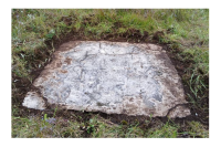
GPS Stations (First Order)Category: Open
The dataset consist of horizontal and vertical coordinates which are very accurate to the cm level in absolute terms. These are used as control coordinates at surveying level control coordinates.
National Land Commission Secretariat
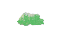
Land Use Land Cover 2020Category: Open
The Land Use Land Cover (LULC) 2020 map of Bhutan highlights major land cover types, with forests dominating at 69% (a slight decrease from 2016). Other significant categories include Snow and Glacier (4.83%), Shrubs (4.11%), and Alpine Scrubs (8.89%, up from 3.39% in 2016). Minor covers include agriculture (2.96%), water bodies (0.61%), and built-up areas (0.25%). The map has an overall accuracy of 87% (kappa 0.853).The Sentinel-2 imagery, acquired from ESA's Copernicus Open Access Hub, underwent several pre-processing steps. The image classification was carried out using random forest technique using the e-cognition software.
Keywords: [#lulc#agriculture#built up#forest#grassland#barren land#glacier#snow#water#landslide#vegetation#meadow]