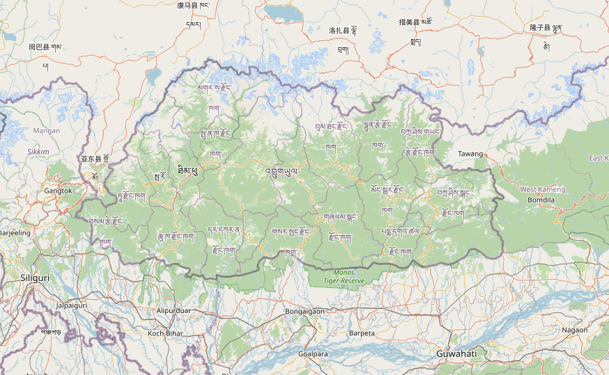
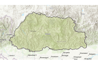
Boundaries
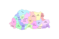
National Land Commission Secretariat
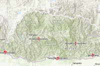
Dzongkhag Boundary Category: Open
The District boundaries of Bhutan are delineated from Topographic maps based on the endorsed administrative boundary descriptions and high-resolution satellite images.
Keywords: [#dzongkhag#area]
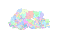
National Land Commission Secretariat
Gewog Boundary Category: Open
Gewog boundaries are the block boundaries dividing the districts into several blocks .The data is derived from Topographic maps.
Keywords: [#gewog boundary#gewog area]
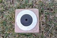
National Land Commission Secretariat
GPS Stations (Second Order) Category: Open
The Secondary Station Control Coordinates are established by means of GNSS observation data for a duration of 1 to 3 hour. These coordinates are processed and adjusted by Total Trimble Control Software (TTC). The accuracy of the coordinates has been achieved at reasonable level for mapping specifications or standards of 10 cm cadastral tolerances.
Keywords: [#control point#secondary control#coordinates#benchmark]

National Land Commission Secretariat
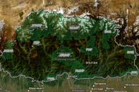
50k_Bhutan Category: Open
The topographic map on a scale of 1:50,000 was based on vertical aerial photographs of the 1950s and field verification in the 1960s. The Survey of India published these topographic maps of Bhutan. Altogether 78 topographic map sheets cover the whole of Bhutan. Later 22 toposheet in 1: 50,000 was completed by June 2001.
Keywords: []
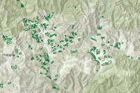
Department of Forests and Park Services
Biological Corridor Category: Common
Biological Corridors (BC) are areas set aside to connect one or more Protected Areas (PA) and facilitate free movement of wild animals which will facilitate long term conservation of wildlife population of wide range of species, promote gene flow and enable species to adapt to climate change impacts.
Keywords: [#biological corridor#area#park]
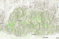
Department of Forests and Park Services
Conservation Parks Category: Common
Conservation parks are geographical areas which are declared as National Park (NP), Wildlife Sanctuary (WS), Strict Nature Reserve (SNR) or any conservation area declared by the parliament of Bhutan and dedicated and managed to achieve the long term goal of conservation of nature with associated ecosystem services and sociocultural values.
Keywords: [#conservation#park#area]
Department of Forests and Park Services
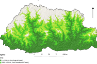
Land Use Land Cover 2016 Category: Common
The LULC (2016) land cover assessment shows a national forest cover of 70.77% (excluding shrubs), of which 45.94% is Broadleaf, 13.53% is Mixed Conifer, 6.02% is Fir, 2.64% is Chir pine and 2.64% is Blue pine. The Alpine Scrub is 3.39%, Shrubs constitute 9.74%, while cultivated agricultural land and meadows account for 2.75% and 2.51% respectively. The snow cover constitutes 5.35% and rocky outcrops 4.15% while water bodies, built up areas, non-built up areas, landslides and moraines constitute less than 1% each
Keywords: [#land use#land cover#settlement#road#water#snow#vegetation#agriculture#forest#grassland]
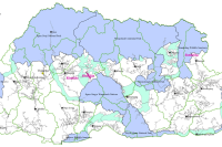
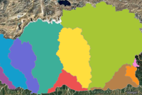
Department of Water
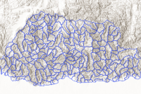
186 Watershed boundary Category: Open
Bhutan is divided into 186 watersheds.
Keywords: [#watershed#area]
Department of Forests and Park Services
Ramsar Site Category: Common
Ramsar sites are wetlands of international importance. Wetlands include rivers, streams and springs with associated riverine and riparian zones; lake, pond, swamp, marsh, fen and peatland with water that is static or flowing with distinct floral and faunal communities. Wetlands provide fundamental ecosystem services, such as water regulation, filtration and purification, as well as numerous scientific, cultural and recreational values. Wetlands are important for maintenance of the broader ecosystem's health.
Keywords: [#watershed#ramsar]
Department of Forests and Park Services
Key Biodiversity Area Category: Common
The KBA are “sites contributing significantly to the global persistence of biodiversity” (IUCN, 2016). In the context of Bhutan, the word ‘global’ in this definition may be replaced with ‘national’ when deemed necessary, and “sites” shall refer to “areas outside protected areas”. As such, KBA are “sites outside protected area networks, contributing significantly to the global and/or national persistence of biodiversity”
Keywords: [#biodiversity#area]
Department of Water
Potential Recharge Area view Category: Common
Land Area in which water percolates through soil to recharge under aquifers that forms marsh, fen, bog, peatland or water, whether natural or artificial, permanent or temporary, with water that is static or flowing, fresh or brackish, including snow and glaciers
Keywords: [#groundwater#hydrology]
Department of Water
Basin boundary Category: Open
Bhutan has an extensive river system that is generally distinguished by main rivers that flow north to south. The main rivers are Amochhu,Wangchhu, Punatsangchhu,and Manas. Manas is made up of Mangdechhu and Dragmechhu. For the purpose of management, Mangdechhu and Drangmechhu shall be considered as two separate basins. Amochhu and Drangmechhu originates in China.There are smaller rivers namely, Jaldakha, Aiechhu, Nyera-Amari, Jomori and Merak-Sakteng.
Keywords: [#basin#boundary#area]
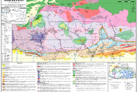
Department_of_Geology_and_Mines
Geologic Map of Bhutan Category: Open
Featured in the Journal of Maps in 2011, this geological map presents a newly compiled 1:500,000-scale representation of Bhutan, along with neighboring areas in India and southern Tibet. Assembled from the most recent and comprehensive mapping datasets available at the time, it offers a significantly enhanced level of structural detail compared to earlier geological maps of the region. Bhutan’s geology is broadly categorized into four major lithological units, arranged from south to north: the Siwalik Group, the Lesser Himalayan Zone, the Greater Himalayan Zone, and the Tethyan Himalayan Zone. Alongside this, the antiformal tectonic window exposing Lesser Himalayan units with the Greater Himalaya, and the synformal klippe of Tethyan Himalayan units—both regarded as characteristic structural features of the Himalayas are also mapped in the Bhutanese Himalaya.
Department of Forests and Park Services
Community Forests Category: Common
Community Forests (CF) are any area of State Reserved Forest Land (SRFL) designated for management by a local community. The Department facilitates establishment of Community Forest to encourage sustainable management of trees and non-wood forest produce by the community to derive socio-economic and environmental benefit.
Keywords: []
Department of Forests and Park Services
Forest Management Units Category: Common
Forest Management Units (FMU) are designated State Reserved Forest Land (SRFL) managed as production forests under an approved Management Plan primarily for production of timber, firewood, and other forest produce.
Keywords: []
National Land Commission Secretariat
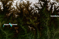
GMC Boundary Category: Open
Established by Royal Charter in December 2024, Gelephu Mindfulness City, GMC is a Special Administrative Region in southern Bhutan. Operating under a “One Country, Two System” model, it possesses full legislative, executive, and judicial autonomy to drive national reform.The city aims to blends Bhutanese spiritual values with technologies innovation, creating a stable, high- growth economy guided by His Majesty The King
Keywords: []
National Land Commission Secretariat
Rehabilation sites Category: Open
The National Rehabilitation Program (NRPO) of Bhutan is a program aimed at reducing poverty by providing land and comprehensive support to landless and social-economically disadvantaged household, enabling sustainable livelihoods and improved living conditions through coordinated efforts of the Office of the Gyalpoi Zimpon.
Keywords: []
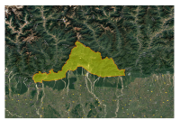
National Land Commission Secretariat
Viewshed Gyalsung Category: Open
This dataset was created to identify and delineate green zone (no-construction) areas surrounding Gyalsung project sites in Bhutan in accordance with official directives to protect peaks, surrounding state land, and visually sensitive areas. Using viewshed analysis based on a Digital Elevation Model (DEM), the data maps areas visible within a 5 km radius from the Gyalsung boundaries and incorporates additional state land near international borders where applicable. The resulting green zone layer serves as a planning and regulatory tool to guide land-use decisions, prevent incompatible development, support environmental conservation, and ensure visual security and landscape protection around the Gyalsung sites.
Keywords: []
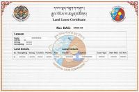
National Land Commission Secretariat
State Land Lease Category: Common
The leasing of State Land (SL) stands as a pivotal initiative undertaken by the Royal Government of Bhutan (RGoB) with the overarching goal of promoting socio-economic development. This process entails the temporary transfer of land-use rights from the government to individuals or entities, fostering support for agriculture, rural livelihoods, and infrastructure development. Emphasizing responsible land use, this approach aligns with the broader objectives of sustainable development within the country.
Keywords: [#leaseland]
National Land Commission Secretariat
Surrendered StateLand Category: Common
This dataset represents registered land parcels that have been surrendered to the State throughvarious mechanisms, including state land exchange, voluntary (willingful) surrender, lease surrender,Tsatong land (land without ownership), acquistion, NCRP carve-outs, and annulment processes. The dataset supports land governance, redistribution, rehabilitation, and planning initiatives of the RoyalGovernment of Bhutan.
Keywords: [#Land surrender#State land exchange#NCRP Carve-Out#Annulment#Land Governance]
National Land Commission Secretariat
Zones_SuperZones_Covid-19 Category: Open
Zone maps for Bhutan's COVID-19 response, providing essential information for effective management and planning, created by the National Land Commission and the Ministry of Health. Its main purpose was to prevent nationwide lockdowns by breaking the country (and major cities like Thimphu and Phuentsholing) down into smaller, managed geographic units based on infection risk.
Keywords: [##zones#superzones#covid-19]
National Land Commission Secretariat
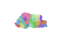
Chiwog Boundary Category: Open
Chiwog boundaries divide the block, Gewog, into several groups of villages for administration. The Chiwog boundaries were delineated during the local government election in 2010,This dataset is unverified and intended for internal reference only. Users are strongly advised to exercise caution and should not rely on this data for legal. administrative, or official purposes. The source-based data is used from the National Statistics Bureau (NSB), topology are cleaned and aligned based on Dzongkhag and Gewog boundaries. The authorities Ownership belongs to the Department of Local Governance (DLG).
Keywords: [#boundary#chiwog#unverified#chiwog area]