Boundaries
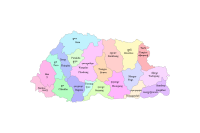
National Land Commission Secretariat
Dzongkhag Boundary Category: Open
The District boundaries of Bhutan are delineated from Topographic maps based on the endorsed administrative boundary descriptions and high-resolution satellite images.
Keywords: [#dzongkhag#area]