Boundaries
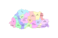
National Land Commission Secretariat
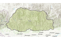
Dzongkhag Boundary Category: Open
The District boundaries of Bhutan are delineated from Topographic maps based on the endorsed administrative boundary descriptions and high-resolution satellite images.
Keywords: [#dzongkhag#area]
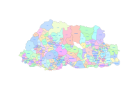
National Land Commission Secretariat
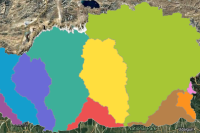
Gewog Boundary Category: Open
Gewog boundaries are the block boundaries dividing the districts into several blocks .The data is derived from Topographic maps.
Keywords: [#gewog boundary#gewog area]
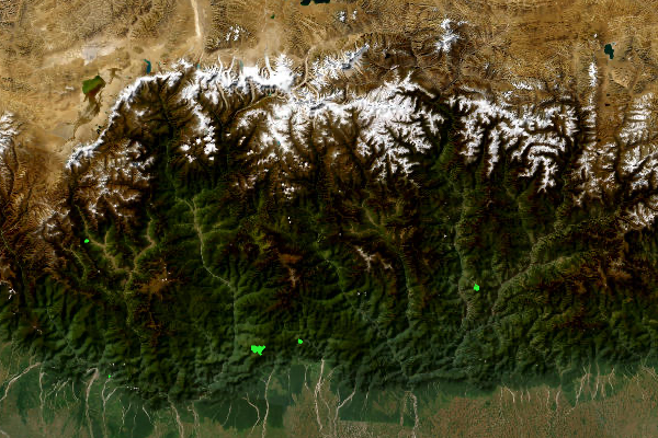
Department of Water
186 Watershed boundary Category: Open
Bhutan is divided into 186 watersheds.
Keywords: [#watershed#area]
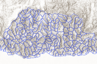
Department of Water
Basin boundary Category: Open
Bhutan has an extensive river system that is generally distinguished by main rivers that flow north to south. The main rivers are Amochhu,Wangchhu, Punatsangchhu,and Manas. Manas is made up of Mangdechhu and Dragmechhu. For the purpose of management, Mangdechhu and Drangmechhu shall be considered as two separate basins. Amochhu and Drangmechhu originates in China.There are smaller rivers namely, Jaldakha, Aiechhu, Nyera-Amari, Jomori and Merak-Sakteng.
Keywords: [#basin#boundary#area]
National Land Commission Secretariat
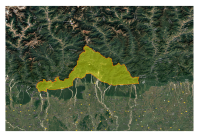
GMC Boundary Category: Open
Established by Royal Charter in December 2024, Gelephu Mindfulness City, GMC is a Special Administrative Region in southern Bhutan. Operating under a “One Country, Two System” model, it possesses full legislative, executive, and judicial autonomy to drive national reform.The city aims to blends Bhutanese spiritual values with technologies innovation, creating a stable, high- growth economy guided by His Majesty The King
Keywords: []
National Land Commission Secretariat
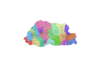
Chiwog Boundary Category: Open
Chiwog boundaries divide the block, Gewog, into several groups of villages for administration. The Chiwog boundaries were delineated during the local government election in 2010,This dataset is unverified and intended for internal reference only. Users are strongly advised to exercise caution and should not rely on this data for legal. administrative, or official purposes. The source-based data is used from the National Statistics Bureau (NSB), topology are cleaned and aligned based on Dzongkhag and Gewog boundaries. The authorities Ownership belongs to the Department of Local Governance (DLG).
Keywords: [#boundary#chiwog#unverified#chiwog area]