Society

National Land Commission Secretariat
Education Centers - Schools Category: Open
The Education Centers dataset contains comprehensive information about educational institutions, including schools, colleges, and universities. It typically includes data such as institution names, addresses, contact information, number of students, etc.
Keywords: [#school#education#college#student]
National Land Commission Secretariat
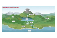
Geographic Names Standardized Category: Open
This data contains the standardized village names in Bhutan achieved through a collaborative effort led by the Department of Local Governance and Disaster Management (DLGDM), with participation from key stakeholders including the National Land Commission Secretariat (NLCS), Department of Civil Registration and Census (DCRC), Department of Culture and Dzongkha Development (DoCDD), and the Election Commission of Bhutan (ECB).
Keywords: [#standardized#village#dzongkhag]
National Land Commission Secretariat
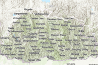
Geographic Names Unstandardized Category: Open
This data contains the unstandardized Geographical names in Bhutan which was compiled by the Geoinformatics division with the help of Topographic division of NLCS through collaborations with LGs (Local governments) and local communities.
Keywords: [#unstandardized#dratshang#land mark#village#tsamdro#chiwog#gewog#lhakhang#school#lake#hill#goenpa#farm#town#grazing land#guest house]
National Land Commission Secretariat
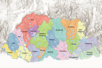
Administrative Centers Category: Open
The Administrative Center Data contains point features representing coordinates of administrative centers across Bhutan, classified by Gewog, Drungkhag and Dzongkhag levels. The data is designed to strengthen governance systems, enhance spatial accuracy, and support administrative mapping and decision-making.
Keywords: []
National Land Commission Secretariat
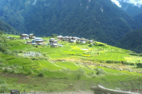
Village Points Category: Open
The village dataset contains point features representing individual settlements and each point is identified by spatial attributes such as coordinates and settlement name. These features enable detailed mapping, spatial analysis, and effective administrative planning of village level infrastructure and services across Bhutan.
Keywords: []
National Land Commission Secretariat
Major Villages Category: Open
The major village dataset provides structured information on key settlements across Bhutan, categorized by class types such as Capital, Town, Village, Hamlet, and House. It captures village names, administrative associations, and geospatial locations to support planning and local governance.
Keywords: []
National Soil Services Centre
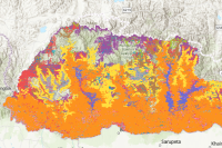
LULC 2010 Category: Common
This dataset is the Land Cover Map of Bhutan (2010). It represents the occurrence and distribution of different types of Land Use and Land Cover in Bhutan. The LULC classes listed here shows Forest cover of 70.46% (Excluding shrubs) with Broadleaf (62.43%), Mixed Coniferous (22.69%), Fir (6.77%), Blue Pine (2.96%), Chir Pine (3.98%) and 1.16% of Broadleaf with conifer. Likewise, Shrubs cover 10.81%, agriculture land and meadows cover 2.93% and 4.10% respectively. The snow cover constitutes 7.44%, bare areas with 3.20%. Marshy areas, non-built areas, built up areas, water bodies and degraded areas with less than 1% each.The average overall map accuracy at the national level is 97.91% with 95.67% minimum and 100.15% maximum at 95% Confidence Level.
Keywords: [#Planning]