Location
National Land Commission Secretariat
Land Use Land Cover 2020 Category: Open
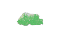
The Land Use Land Cover (LULC) 2020 map of Bhutan highlights major land cover types, with forests dominating at 69% (a slight decrease from 2016). Other significant categories include Snow and Glacier (4.83%), Shrubs (4.11%), and Alpine Scrubs (8.89%, up from 3.39% in 2016). Minor covers include agriculture (2.96%), water bodies (0.61%), and built-up areas (0.25%). The map has an overall accuracy of 87% (kappa 0.853).The Sentinel-2 imagery, acquired from ESA's Copernicus Open Access Hub, underwent several pre-processing steps. The image classification was carried out using random forest technique using the e-cognition software.
Keywords: [#lulc#agriculture#built up#forest#grassland#barren land#glacier#snow#water#landslide#vegetation#meadow]
