Planning and cadastre
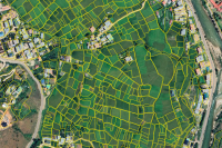
National Land Commission Secretariat
Cadastral Boundary Category: Open
Cadastral plot shapes data of the cadastre. Containing plot boundary shapefile data.
Keywords: [#Plot Boundary#cadastral#id#area]
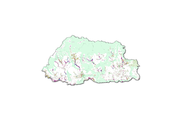
National Land Commission Secretariat
National Land Use Macro Zones_Baseline2023 Category: Open
This dataset presents the consolidated macro-zone layers derived from the NLUZ Baseline 2023. It integrates sectoral datasets from multiple agencies and includes eight major land use macro zones: Agricultural Land, Rural Settlement, Sustainable Forest Management Area, Nature Conservation Area, Industrial, Cultural Heritage, Urban, and Rangeland. It also incorporates key right-of-way buffers such as highway buffers, transmission line buffers, and flight funnel buffers. The dataset represents a generalized macro-level spatial output of the NLUZ Baseline 2023 consolidation exercise.