Web Maps
Map,Dashboard, Scene, Story Map and Apps made with Experience Builder are shared here
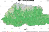
Land Use Land Cover map 2020
The Land Use Land Cover (LULC) 2020 assessment in Bhutan aimed to provide comprehensive information about the distribution of major land use and land cover types in the country. Periodic assessments of land use changes are crucial for strategic planning at national and local levels. LULC information plays a crucial role in various national interventions concerning vital issues such as climate change, food security, and environmental sustainability.
Open
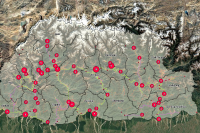
Alienable State Land in Seven Dzongkhags
This GIS-based Multi-Criteria Decision Analysis (MCDA) supports the National Land Use Zoning (NLUZ) by identifying legally and environmentally suitable state land across 7 Dzongkhags.
Open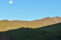
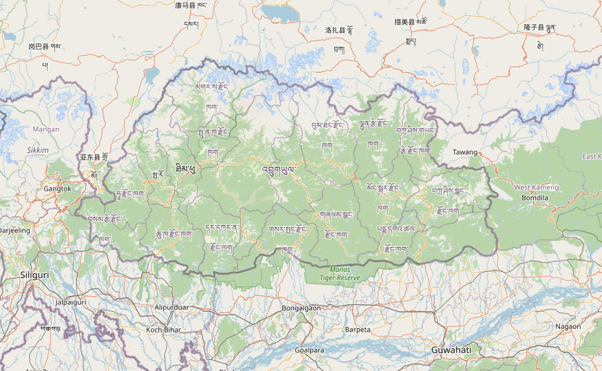
Reflection of Dagala Tsamdro Management Plan
Introduction to Dagala Rangeland Through the Song Daga Lamai La ZhuThe traditional song Daga Lamai La Zhu beautifully captures the landscape of Dagala rangelands, where yak herders have lived for generations. It praises the mountains, lakes, and alpine meadows that form the heart of their grazing grounds. The central figure, Penzo Bum, linked to the mountain goddess Ama Jomo, symbolizes the herders’ spiritual connection to the land. Practicing seasonal transhumance, herders move between high summer pastures and lower winter areas, with the song reflecting their deep attachment to these slopes. Passed down orally, it helps preserve the cultural identity and pastoral traditions of Dagala’s yak-herding communities.Brief route of Dagala Ridge which we covered during field visit.Start from Geneyzam BaseHike up to Jasey Dungko ViewpointContinue to Kepchen (lunch point)Cross Paga Laptsa PassReach Watsachen campsite (Halt for 2 days 3 nights)Next Day:Trek to Labatama (Wangdrog area)Cross Labazhung PassStop at Pangka (lunch point)Cross Tshalila PassReach Kherighiwa campsite(Halt for 1 days 2 nights)Final Stretch:Cross Japhula PassRoute splits here — option to divert to Changang or GasatshogomTeam descend toward Geneyzam Base, passing:ZhacheyThewsheyGhangrimReach the first village: Geneykha
Open
Topo 3DMap for Demo
This scene is intended solely for demonstration purposes as a 3D basemap, presented in the Esri Topographic cartographic style
Open
Climate Risk assessment in Lingzhi Drungkhag
Team Members: Thinley Norbu, Pema Wangchuk,Yeshi Gyeltshen, Dechen Zangmo and Tamana Gyimiri (MSPCL), Tshewang Phuntsho(DoC), Thinley Dorji(DoFPS), Nangsi Wangdi(NLCS), Kencho Wangdi Chief of Traditional Medicine Division(TMD).Purpose: The visit to Lingzhi was carried out to assess the current and potential climate risks affecting the community, rangelands, and livelihoods. The assessment aimed to gather field-level observations and stakeholder inputs to inform adaptation planning.The journey from Barshong to Lingzhi Gewog via Zhodu, covering a span of two to three days on foot, provides valuable insights into climate-related risks and the condition of rangelands across diverse altitudinal zones.
Open
Pumola Trek
The Pumola hike is a memorable and enjoyable day hike that takes you through some of Bhutan’s most breathtaking landscapes and cultural attractions. The hike begins in the capital city of Thimphu and takes you through the beautiful coniferous forests, past the Phajoding Monastery, and over mountain ridges and magical pasture land.As you make your way towards the highest peak at an altitude of 4,035 meters, you’ll have the opportunity to see some of the modern developments of Thimphu city, as well as the stunning natural beauty of the vicinity of Thimphu city. Along the way, you’ll also pass the Buddha Point or Buddha Dordenma, a massive statue of Shakyamuni that is one of the tallest sitting Buddha statues in the world.
Open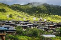
Merak to Jomotshangkha Trek
Merak is one of the remotest gewogs under the Merak-Sakteng Drungkhag in Trashigang Dzongkhag and it has an area of 867.7 Km2. It is located in the eastern part of the Dzongkhag and shares a boundary with Shongphu gewog in the west, Sakteng gewog in the north, Kangpara gewog in the south and the Indian state of Arunachal Pradesh in the east. Merak lies in the valley of Nyera Ama RI and the altitude is about 3400-3500m above sea level. Nyakchung La, which is about 4100m and above is the pass between Merak and Sakteng gewogs and it stretches from latitude 270 17.84 to 270 18.51N and from longitude 910 50.76 to 910 52.12 E.( report on soils of Merak Sakteng, 1999). The Merak gewog office was constructed in 2005 and gewog has 5 Chiwogs via Merak Khatoed, Merak Khamed, Gyengo, Khelephu and Khashetng. Khelephu and Khashetng are on the lower part of the gewog where agriculture crops can be grown. The people of Merak are mostly dependent upon livestock and livestock products. Though some vegetables are grown Merak no other cereal crops can be grown in such a high altitude. Maize, barley, potatoes, and vegetables are grown in the lower areas like Khasheteng and Khelephu.
Open